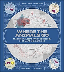
 Where the Animals Go
Tracking Wildlife with Technology in 50 Maps and Graphics
Review posted January 12, 2018.
W. W. Norton & Company, 2017. First published in Great Britain in 2016. 174 pages.
Starred Review
2018 Sonderbooks Standout:
#5 General Nonfiction
This is an amazing, fascinating, and eye-catching book.
This book is a set of maps and charts showing how animals move around the world. There are migrations diagrammed and feeding patterns and responses to wind currents. There are maps for every continent and every ocean, and there are maps for land animals, creatures of the air, and creatures of the sea. The format is extra large, and some pages pull out to be even larger. All the maps and graphics are beautifully done.
I thought I could read through this book quickly, because so many of the oversize pages are covered with maps. But there’s text to go with every map, and the print is tiny! So it took me longer than I thought, and it would take some time even to read just a map or two.
Here’s how the Introduction begins:
From footprints to fallen feathers, nests to droppings, the history of where animals go has been a history of physical traces. This book is about a new era, one in which the traces we follow are imprinted not in the earth but in the silicon of computer chips. And while the maps and studies we feature rely heavily on data processing, the desire to study animal movements with new inventions long predates the Information Age. In 1803, John James Audubon was tying threads to the legs of songbirds in order to prove that the same individuals returned to his farm each spring; a map from 1892 illustrates the month-by-month migration of seals in the North Pacific; in 1907, a German apothecary equipped pigeons with automatic cameras in order to document their journeys; in 1962, three scientists from the University of Illinois taped a radio transmitter to a duck; and in 1997, two of the world’s first GPS collars confirmed that elephants from Kenya sometimes cross the border into Tanzania.
The maps in this book show things about animals such as baboon troupes in Kenya, mountain lions crossing the Alps, elk inside and outside Yellowstone, pheasants in the Himalayas, pythons in the Everglades, information flow among ants, sharks around Hawaii, sea otters in Monterey Bay, bird migration paths, and density of penguin colonies.
Each page is packed with information – so it’s no wonder it takes a long time to read – but the maps are eye-catching and communicate lots of information quickly. You’ll be pulled in, then want to know more.
This book lets you in on new discoveries scientists are making about animals all the time – now that we have more effective ways to track them and learn about their worlds.
Once you open this book, you’ll have a hard time putting it away.

